Kirkuk, Iraq — Citizen Science Archive
كركوك، العراق — أرشيف علم المواطن
کرکوک، عێراق — ئەرشیفی زانینی شارستانی

STORIES
OF KHASA

حكايات
خاسة

چیرۆکەکانی
خاسە

Documenting the river through science, memory, and community knowledge. نشهد على النهر بالعلم، والذاكرة، وما يعرفه أهله عنه. ڕووبارەکە بە زانست و بیرەوەری و ئەوەی خەڵکی دەوروبەر دەزانن، تۆمار دەکەین.

A river is remembered before it is measured. يُحفظ النهر في الذاكرة قبل أن يُقاس بالأرقام. پێش ئەوەی بە ژمارە پێوان بکرێت، ڕووبار لە یاددا دەمێنێتەوە.

Scroll إلى الأسفل خوارتر بڕۆ
Context

This archive extends "It Doesn't Travel Downstream" — the StoryMap that named what Kirkuk already knew: that knowledge about the Khasa has never reached the people who live with it. We are building the archive that fills that gap.
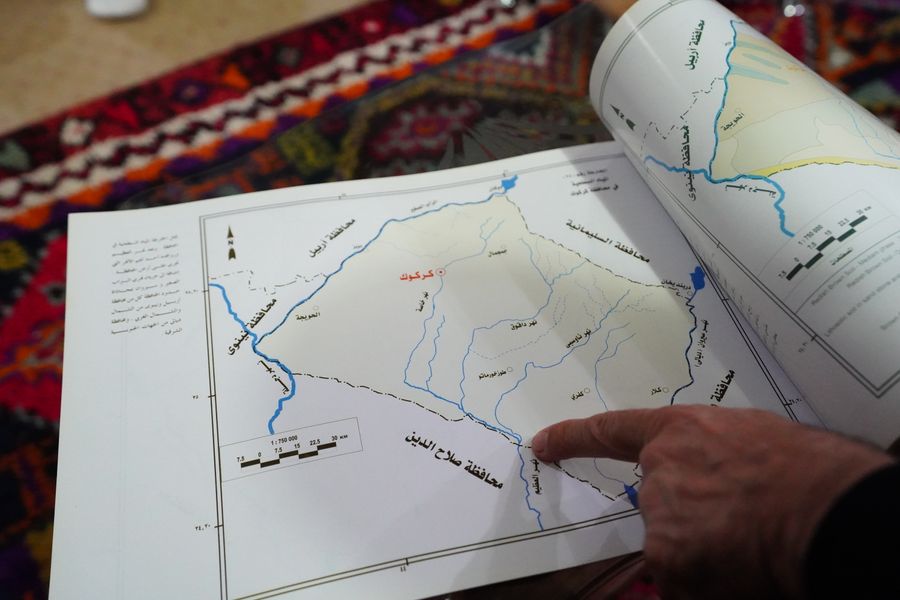
View StoryMap →
The River

What is Khasa?

A river 468 km² in basin, semi-arid in climate, and now semi-absent from memory. This is its timeline.

Pre-1970s
The Living River
Children swam in the Khasa through summer. Farmers drew from it for irrigation across the surrounding plains. Oral accounts describe it as perennial — always flowing, always present.
1970s – 1990s
Kirkuk Expands
Urban growth accelerated. Industrial activity intensified around Kirkuk's oil infrastructure. The river began absorbing untreated industrial and domestic waste.
2009 – 2014
Khasa Chai Dam
An earth-fill dam with clay core was built 7.4 km north of Kirkuk — 58m high, 2,360m long, with a storage capacity of 46.36 million cubic meters. The dam reshaped how the river moves.
46.36 MCM storage capacity
2021 – 2025
Science Documents the Decline
37 samples across 8 observation points found water quality under pressure from urbanization. Raw turbidity exceeds safe limits. A 14km channel survey found flood risk in multiple reaches. Even now, basic basin data is still being assembled.
8 sampling points · 14km DGPS survey · 73 cross-sections
Today
A River Without a Full Record
Kirkuk's water resources are in a critical state. Monitoring gaps are real. The people who know this river best have never been asked to document it. This archive is that documentation.
Oral History

The River in Memory

A lab test can tell you what is in one jar today. Oral history can tell you what disappeared from an entire neighborhood over ten years. Both are evidence. These accounts are drawn from interviews in It Doesn't Travel Downstream.

Karez Library
The Khasa was highly biodiverse — plants and birds you rarely see now. Migrating birds like pink flamingos used to come here in the 1970s. As Kirkuk's population grew, that life around the river dwindled too.
Mr. Tariq Karezay Kirkuk Recorded 2025
Along the Khasa
As a young farmer I enjoyed birdwatching, swimming, and working on the river. I left farming when I came of age because other work was more sustainable. Even now, I still ride my bike around the area.
Mr. Arif Kirkuk Recorded 2025
Shorja
My family are generations of farmers. I farmed along the river until 2014, but I had to keep moving upstream. Starting in 2007, as groundwater dried up, I moved up until I was farming in Shorja.
Mr. Samad Shorja Recorded 2025

Your memory belongs here too.

Share an oral account on Instagram →
Photo Archive

The River in Images

28 photographs

Select any image to browse the gallery

Then & Now Drag the handle to compare
Before
Now
Khasa River archive photograph
Spatial Evidence

The River on the Map

Community-submitted locations, water sample points, and oral history sites — each pin is a piece of the record.

Water sample point
Community story
Photograph location
Flood risk reach
Water Quality

The River in Numbers

Not "what is electrical conductivity." But: what does this number mean for the water your family uses?

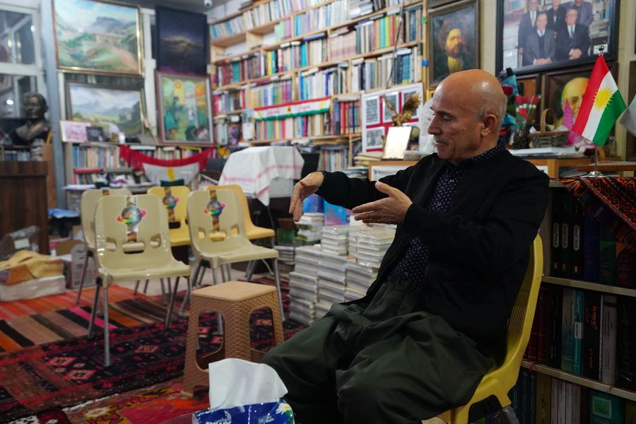
"Scientists collect water samples. Communities collect memories. The Khasa needs both."

pH
7.4 pH
Slightly Alkaline
Safe drinking range is 6.5–8.5. The Khasa sits within bounds, but this shifts with season. Upstream agricultural runoff pushes it toward alkaline in summer months.
✓ Within safe range
TDS — Total Dissolved Solids
980 mg/L
Elevated
This means the water carries dissolved minerals, salts, and urban runoff. WHO recommends below 600 mg/L. High TDS affects taste, pipe corrosion, and long-term health if this is your drinking water source.
⚠ Above WHO recommendation
Turbidity
18 NTU
High — Seasonal
Turbidity measures cloudiness. Untreated raw water from the Khasa was classified as unsuitable for drinking before treatment. High turbidity can carry pathogens and indicate heavy sediment from upstream. Safe for drinking is under 1 NTU after treatment.
✗ Requires treatment before consumption

How this data was collected: 37 samples from 8 observation points along the Khassa-Chai River, collected across winter and summer by Abdulamir Qasim (2021). Data reflects conditions under urbanization pressure. These numbers are not alarming in isolation — they become meaningful when compared across time, across neighborhoods, and against what residents remember.

Community Archive

Make the River Visible

We are not asking you to become a scientist. We are asking your neighborhood to become visible. Share a memory on Instagram, or send a photo or location on WhatsApp.

💬
WhatsApp

Photos and locations go to Zheen Salih Abdullah, Project Lead, on WhatsApp. Stories and oral accounts are welcome on Instagram.

Open WhatsApp